We headed out of Waitsfield at 9 am on the shuttle with Simba, a hiker who recently finished the Colorado Trail, and with Messy and Lost Boy. The first climb of the morning up Baby Stark Mountain and then Molly Stark's Balcony were pretty tough, the rock climbing beginning almost immediately with tough downhills (read rockslides) to follow. We did actually get some pretty views though and got some photos before moving down to Birch Glen shelter. We took a quick break here and said hello to Bernard, who was just heading out, and for some water. The walking from here to Cowles Camp shelter wasn't too bad, not steep or too muddy, and we made it there for lunch.

A typical day on the Long Trail.
We were eating with Dave and Simba and Bernard showed up shortly after. We noticed a sign on the wall stating that the next five miles can be expected to take us four to five hours and were pretty surprised being that the profile didn't show that kind of elevation. We began our climb up to Burnt Rock Mountain and understood why the hike would take so long. Much like the White Mountains, the GMC has decided that instead of walking upright you would much rather climb up and over large rock features, especially when they're wet. The climb up was 1.5 miles and took an hour. I slipped off one of the ropes that you use to rappel (yes, rappel) down the side of a rock and got a nasty rope burn on my left hand. From this point, we entered Ladder Ravine, named so because you have to pull yourself up a wet rock on a rope to a wet metal ladder and climb down it, only to climb back up some more wet rocks.

Ladder Ravine
After Ladder Ravine we had our first Moose sighting, but not the large animal... Our friend Moose was hiking southbound! We stopped and chatted with him a while and he let us know the trail ahead. After taking the break the trail mellowed out a bit, only becoming steep a few times and was mostly wet and muddy. We climbed Ethan Allen Mountain and were treated to some more hazy views as it had been drizzling off and on this afternoon.

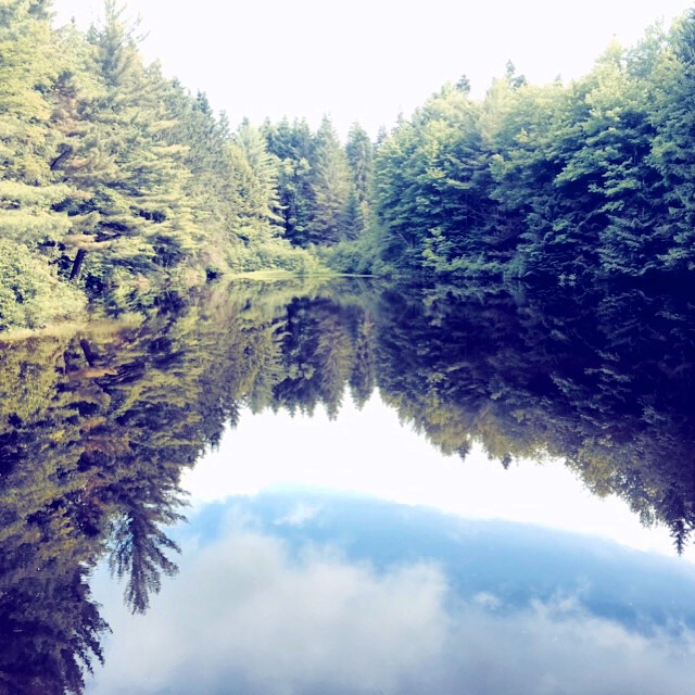
The view from Ethan Allen with clouds looming!
We had a mile downhill to the shelter at this point and made it there pretty uneventfully. The shelter is very nice, but there was a family headed over the mountain with a pretty obnoxious and loud kid staying in the shelter so we tented. It started raining right as we cooked our dinner, a short thunderstorm, but thankfully our tent was already set up. A caretaker showed up to collect our fee (surprise, the guidebook didn't list this one) and we called it an early night after a tough 10.6 miles.
Tomorrow they are calling for rain all day and we have to do at least 15 miles or only about 6. We may end up taking a side trail as these brutal and masochistic miles today will not bode well in the rain!